Documenting Temples: Understanding different techniques, scope, strengths, and limitations of documenting built heritage
Introduction
In the process of conserving cultural heritage, there are three main phases highlighted in The Burra Charter: the Australia ICOMOS Charter for Places of Cultural Significance (2013). The first is understanding the significance of heritage; the second is developing a policy for it; and the third is managing the heritage site in accordance with the policy. [1] It is crucial to have a holistic understanding of the significance of heritage sites. Data collection on cultural heritage sites is based on various primary and secondary documentation techniques and sources.
Cultural heritage sites may be vandalised by human actions such as conflict and war, uncontrolled urbanisation, and rampant tourism, or even actions of nature like tectonic shifts, floods, ground settlement, or undesired dense vegetation growth. For instance, on September 21, 2023, the Parliament Standing Committee on Transport, Tourism, and Culture shared a report highlighting that the Comptroller and Auditor General (CAG) identified 92 missing centrally protected monuments. [2] Of these 92 monuments, 42 have been located by the Archaeological Survey of India (ASI). Rapid urbanisation and submersion under reservoirs or dams have lost the remaining 50 monuments, leaving them untraceable.
Historically, changes in the political and cultural landscapes have had implications for the cultural heritage. Therefore, the documentation of cultural heritage sites is imperative. It is crucial to document sites not just during the initial stages of the conservation process, but throughout all stages. This means not only recording the latest weathering after the structure's restoration works, but also studying the monument's impact on its environment and its socioeconomic implications for society. This helps cultural heritage specialists make better-informed decisions for policymaking and management strategies.
When documenting heritage sites, more accurate data leads to more constructive policies for their restoration and management. Technological advancements have led to the development of multiple documentation techniques that gather precise data on heritage sites in the most convenient ways. Digital technology has replaced mechanical tools and equipment. Adopting this will result in the implementation of more effective policies. Therefore, implementing newer documentation techniques will result in more effective policies for the conservation of heritage sites.
Documentation Techniques and their Categorization
Conservation specialists confirm the best approach to documenting a given heritage site based on the accuracy, time, and other physical conditions. In his paper, F. Hassani categorizes documentation techniques into non-image-based, image-based, and combinative methods. [3]
Image-based documentation techniques
Taking and archiving photographs is crucial to preserving the physical details of heritage sites. Image-based documentation uses photographs to gather information about the object of interest. Photogrammetry and infrared cameras are the main examples of such techniques.
- Photogrammetry: Photographs are used to extract information about objects. It allows us to interpret, measure, and even create 3D models based on these images.
a) Panorama photogrammetry, capturing a scene with multiple images, is a powerful alternative to traditional 3D modelling. Software stitches together the captured images to create a single, complete model. It avoids complex modelling and allows for measurement directly from the images, especially with proper calibration. Panoramic cameras simplify the stitching process, making it reliable and efficient. Its key strength lies in capturing vast areas with minimal photos.
Its advantages include cost-effectiveness, time efficiency, and ease of use on digital platforms. However, it has some drawbacks, including large file sizes, the need for specialized software, limitations in confined spaces, and restricted camera angles.
b) Close-range photogrammetry offers a fast and accurate way to document objects using overlapping photographs. The software simplifies data capture and processing, creating colour and texture data, precise measurements, and 3D models. This non-contact method is ideal for delicate objects and limited access situations. Its applications would include recording buildings, artifacts, and excavation sites; monitoring structural changes and deformations; reconstructing destroyed objects; and generating 3D models for historic sites.
The advantages of close-range photography include efficient data capture and processing, creating detailed 3D models, providing colour, texture, and metric data, extracting geographical information, and being cost-effective and portable. The limitations of close-range photography include the need for expertise, the reliance on camera quality and proper image capture, and the object's complexity and accessibility.
Unmanned Aerial Vehicles (UAVs), also known as drones, are remotely controlled flying machines that have revolutionised various industries, including cultural heritage documentation.
UAVs offer a significantly more affordable alternative to traditional manned aerial photogrammetry, making 3D documentation accessible for a wider range of projects. Data acquisition with UAVs is faster compared to traditional methods. They can quickly capture images from various angles with minimal disruption to ongoing fieldwork. It excels at capturing high-resolution images and 3D models of objects and sites in challenging locations. They can reach areas that are difficult or dangerous for humans or traditional manned aircraft to access.
However, due to their lightness, UAVs are more susceptible to vibrations caused by wind, which can impact the quality of captured data. They typically have a smaller payload capacity compared to manned aircraft. This limits the types and number of sensors they can carry. While user-friendly options are emerging, successfully operating UAVs for cultural heritage documentation often requires specialized training and expertise in flight control and data processing.
2. Infrared (IR) cameras: Unlike visible light, IR radiation corresponds to heat and has a longer wavelength invisible to the human eye. Infrared cameras are able to capture information beyond the visible spectrum. This makes IR cameras valuable tools in conservation efforts.
IR cameras detect thermal variations on a surface, revealing hidden structures beneath paintings and frescos. This allows for the study of preparatory drawings (pentimenti), underlying layers, and potential structural weaknesses. The technology helps analyze the composition of objects and buildings. This information is crucial for understanding construction materials, conservation needs, and potential deterioration risks. A significant advantage of IR cameras is their non-destructive nature. Unlike invasive techniques, IR imaging provides valuable insights without harming the cultural heritage object. These are particularly good at detecting moisture and rising dampness in buildings. This information is vital for identifying potential structural issues and guiding restoration efforts. Thermal variations can highlight cracks in walls and structures, aiding preventative maintenance and early intervention for potential damage. Furthermore, it is possible to seamlessly integrate IR images with visible light photographs and 3D models. This combined approach facilitates a deeper understanding of the object and allows for quantitative damage analysis using empirical data.
Several factors, such as humidity, air temperature, and material emissivity, can influence the thermal distribution captured by the IR camera. Careful consideration of these factors is necessary for an accurate interpretation of the results. Also, operating and interpreting IR data requires specialised knowledge and training. To effectively use the technology in documentation and analysis, cultural heritage professionals must understand its capabilities and limitations.
Non-image-based documentation techniques
- Traditional terrestrial survey: These methods use range-based tools to directly acquire the coordinates of various points on the site or object of interest, whereas image-based documentation techniques do not.
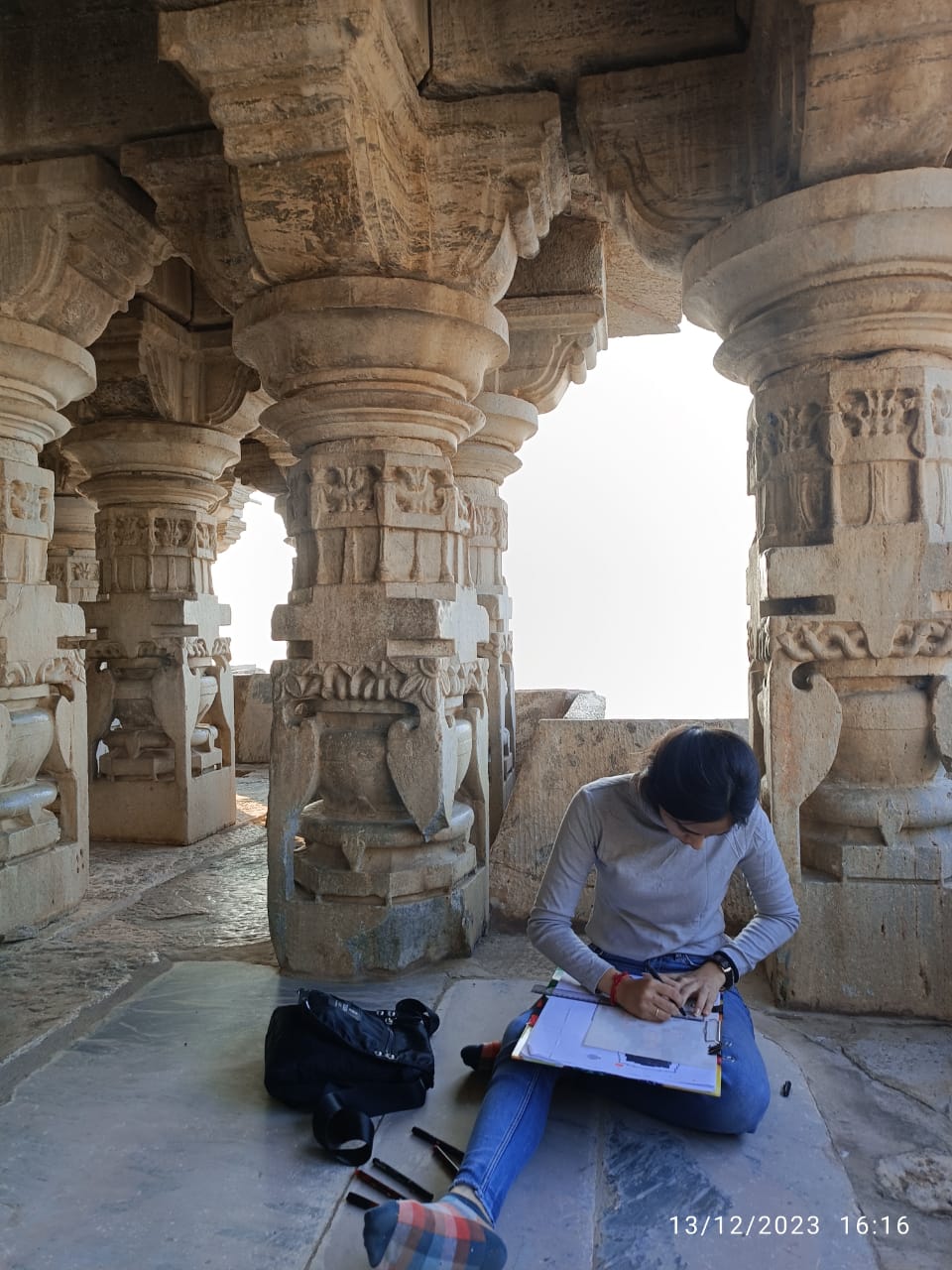
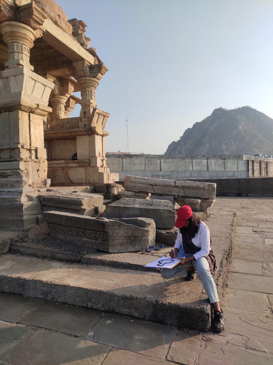
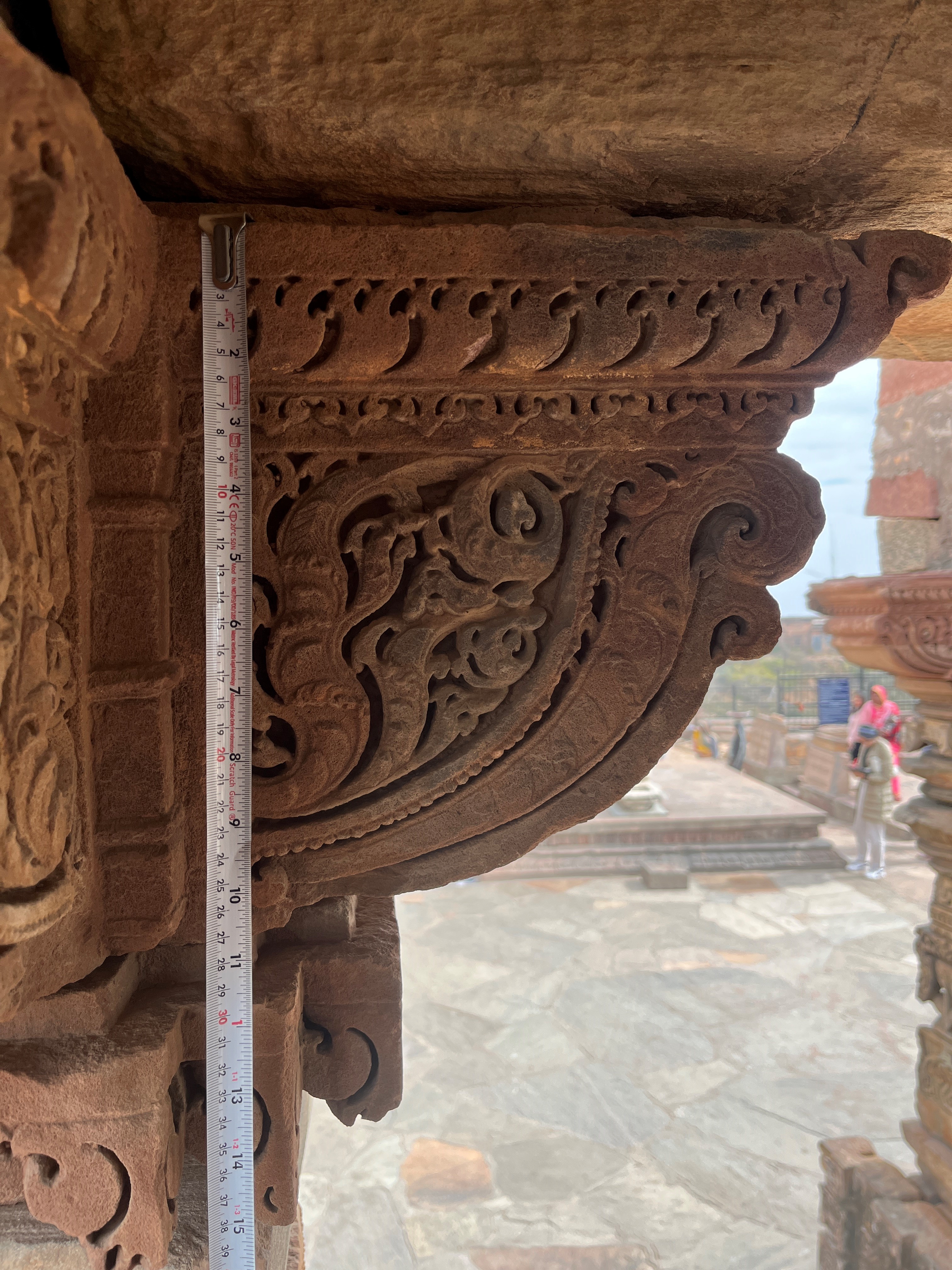
a) Hand survey: This method involves taking manual measurements using simple tools like measuring tapes, laser distance meters, and levels. A pre-drawn sketch records the results, which CAD (computer-aided design) software can then process to create detailed drawings.
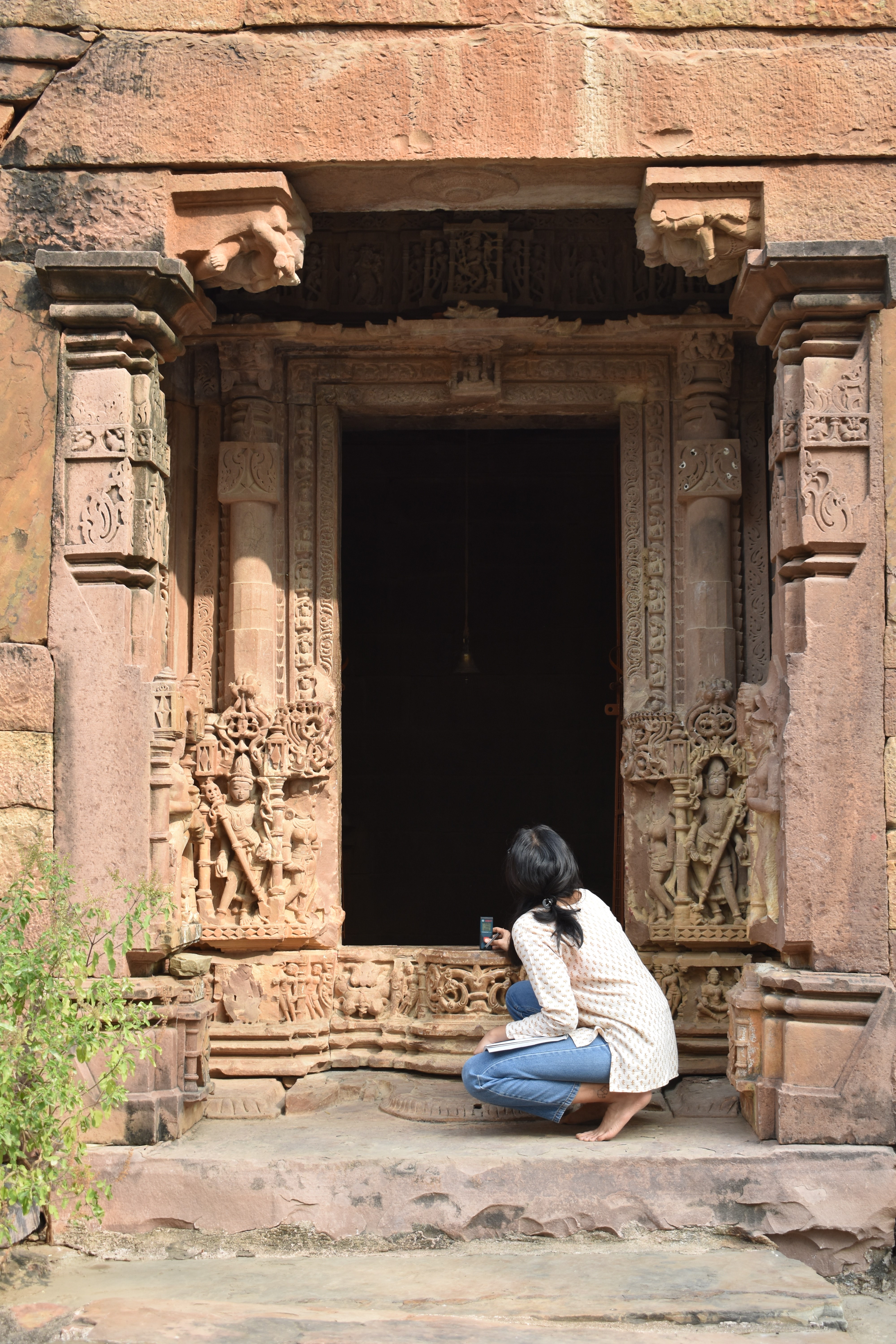
It is cost-effective and requires minimal equipment. It is particularly beneficial in situations where visibility is limited, allowing non-experts or individuals with basic surveying knowledge to perform the survey. Hand surveying has several drawbacks, including its time-consuming and labor-intensive nature, its unsuitability for measuring curved or highly detailed surfaces, its limited accuracy compared to other digital methods, and the need for meticulous documentation in the field to recover any missing information.
b) Theodolite measurement: Theodolites are instruments that measure both angles and distances simultaneously. They survey topography, determine precise coordinates, and capture the outlines of objects, including those with curved surfaces. The collected data can be used to generate wireframe models, which can be further refined using CAD software to create solid 3D models.
Theodolite provides accurate measurements and is relatively cost-effective compared to other advanced methods. Its limitations are that it requires skilled professionals, and if the architectural forms are complex, it can be time-consuming. This method can be inefficient if the form is detailed and requires a large number of measurements. The data must be meticulously recorded while on site, just like with hand documentation.
- Laser scanning: Laser-scanning technology has revolutionised cultural heritage documentation by offering a rapid and highly detailed method for capturing 3D data of objects and structures.
a) Terrestrial Laser Scanner (TLS): A TLS is a robotic surveying tool that utilises lasers to rapidly collect distance and angle measurements, creating a dense point cloud representation of the target object. Unlike traditional methods that require reflectors, the TLS scans a network of points without the need for additional equipment. With a field of view similar to the human eye, the TLS can be computer-controlled and integrated with GPS for precise positioning.
TLS captures vast amounts of real-time data in a short time period, significantly reducing fieldwork compared to that required with traditional methods. It produces highly accurate 3D models, ideal for capturing intricate details on irregular objects. The 3D point cloud versatility can be used for various purposes, including generating 2D drawings, sections, and solid 3D models. TLS is applicable to diverse projects and can be used to document a wide range of objects, from small artefacts to large, complex buildings. It can function independently or be seamlessly integrated with other surveying techniques for a comprehensive approach.
Besides its advantages, TLS can struggle to accurately capture data on surfaces with sharp edges or sudden changes in depth. While some scanners integrate digital cameras, generally, TLS primarily captures 3D geometry and lacks detailed colour and texture data. Objects or hidden sections can impede a complete survey, requiring additional scanner positions to fill in gaps. Its highly reflective surfaces can disrupt laser readings, compromising data accuracy. Furthermore, water absorption in near-infrared spectra can have an impact on data quality, especially in humid environments. The laser beam's size and minimum range may limit its use in very small, confined spaces. TLS equipment can be expensive, and operating the scanner and processing the data effectively requires specialised training.
b) Light Detection and Ranging (LIDAR): LIDAR is a remote sensing technology that utilises lasers to generate high-speed digital surface models (DSM) of large areas. Similar to TLS, LIDAR measures distance using laser pulses and calculates the coordinates of targeted points. Often mounted on aircraft or drones, LIDAR systems can be particularly useful for surveying vast landscapes or archaeological sites.
LIDAR excels at capturing vast amounts of data across large areas in a short timeframe. Unlike traditional photogrammetry, some LIDAR systems can penetrate vegetation cover, allowing for detailed surveying of both the ground surface and overlying vegetation.
However, the laser pulses can be scattered by air molecules and dust particles, affecting accuracy. Additionally, LIDAR data may not be as detailed as TLS for capturing intricate features on complex structures. Laser scanning's ability to quickly capture vast amounts of highly accurate 3D data makes it invaluable for a variety of projects. However, understanding their limitations in capturing specific details, handling reflective surfaces, and operating in confined spaces is critical for optimal utilization.
Combination Techniques
- Photo-laser scanners: Photo-laser scanners are a powerful hybrid technology that combines the strengths of photogrammetry and laser scanning, addressing some of each method's limitations. A photo-laser scanner is a combination of a close-range photogrammetry system and a laser scanner. This integrated approach captures both high-resolution images and a dense point cloud of the target object. Special, highly reflective markers are used during the scanning process. The software can automatically recognise these markers due to their distinct reflective properties, allowing for the effortless transformation of laser points into a standard coordinate system. The process of using photo-laser scanners involves a laser scanner first meticulously scanning the entire target object and generating a detailed point cloud representation. Then, a digital camera mounted on the scanner captures high-resolution images of the object. Finally, the captured images are integrated with the corresponding points in the point cloud. The process assigns colour and texture information to the 3D model.
Photo-laser scanners address the laser scanner's weakness in capturing sharp edges. The high-resolution images provide detailed information about edges and cracks, enhancing the accuracy of the final 3D model. Unlike traditional laser scanners, photo-laser scanners provide valuable colour and texture information alongside the 3D geometry, creating a more realistic representation of the object. This combined approach offers a significant advantage in terms of speed. The laser scanner swiftly captures the 3D structure, and it can reduce overall fieldwork time by using a single image for texture mapping. The ability to capture intricate details, including inscriptions and reliefs, makes photo-laser scanners effective in cultural heritage documentation.
Nevertheless, photo-laser scanners are generally more expensive than standalone photogrammetry or laser-scanning systems. Additionally, the technology requires specialised training for effective operation and data processing. The use of highly reflective markers can be intrusive or impractical for certain cultural heritage objects. Removing or concealing the markers after scanning may require additional processing steps. Lighting conditions during data capture can affect image quality, similar to photogrammetry. Uneven or harsh lighting can create inconsistencies in the final model.
- Structured light scanning: Structured light scanning offers a valuable technique for 3D documentation of cultural heritage, particularly for capturing intricate details on objects. This method projects a specific light pattern onto the target surface and uses one or more cameras to capture the deformed pattern. Using triangulation principles, the system calculates the 3D geometry of the object. This method projects a single or a sequence of coded light patterns onto the object. These patterns are captured by a camera system. The patterns' unique codes allow for precise matching between corresponding points in the images and the projected patterns, facilitating the 3D reconstruction process.
Structured light generates numerous corresponding points between images, streamlining the modelling process compared to traditional photogrammetry. The use of coded light patterns enables faster and more accurate 3D model generation. Structured light shares some principles with photogrammetry, but it uses light patterns for automated matching, improving efficiency. Although operating structured light scanners and processing the data effectively requires specialised skills and complex software.
a) DAVID laser scanner: This cost-effective system includes a computer, a video camera, a background with control points, and a line laser source. Software based on triangulation principles helps the user manually move the laser around the object to capture data. The software can also integrate colour and texture information into the generated 3D model.
The scanner is an affordable option for 3D documentation and is particularly valuable for small object capture. It is relatively simple to operate, making it accessible to users with less technical expertise. The scanner's self-calibration capability eliminates the need for additional calibration procedures.
But the DAVID scanner relies on the user manually moving the laser source, potentially introducing user error. The scanning approach primarily suits it for documenting smaller objects.
b) Kinect: The Kinect sensor, originally designed for gaming applications, is an RGB-D camera that incorporates structured light technology. It projects an IR pattern and captures both colour (RGB) and depth (D) data (that is, RGB-D), enabling the real-time generation of basic 3D models.
The Kinect is a relatively inexpensive and portable system, making it accessible for cultural heritage documentation projects. Small indoor spaces like narrow corridors or staircases, where larger scanners might be impractical, are ideal for documenting with the Kinect. The Kinect can be used to capture 3D data and generate point clouds of small objects and statues. The Kinect's depth-sensing capabilities are ineffective for outdoor environments. While user-friendly for data acquisition, advanced post-processing skills are necessary for achieving high-quality results.
Conclusion
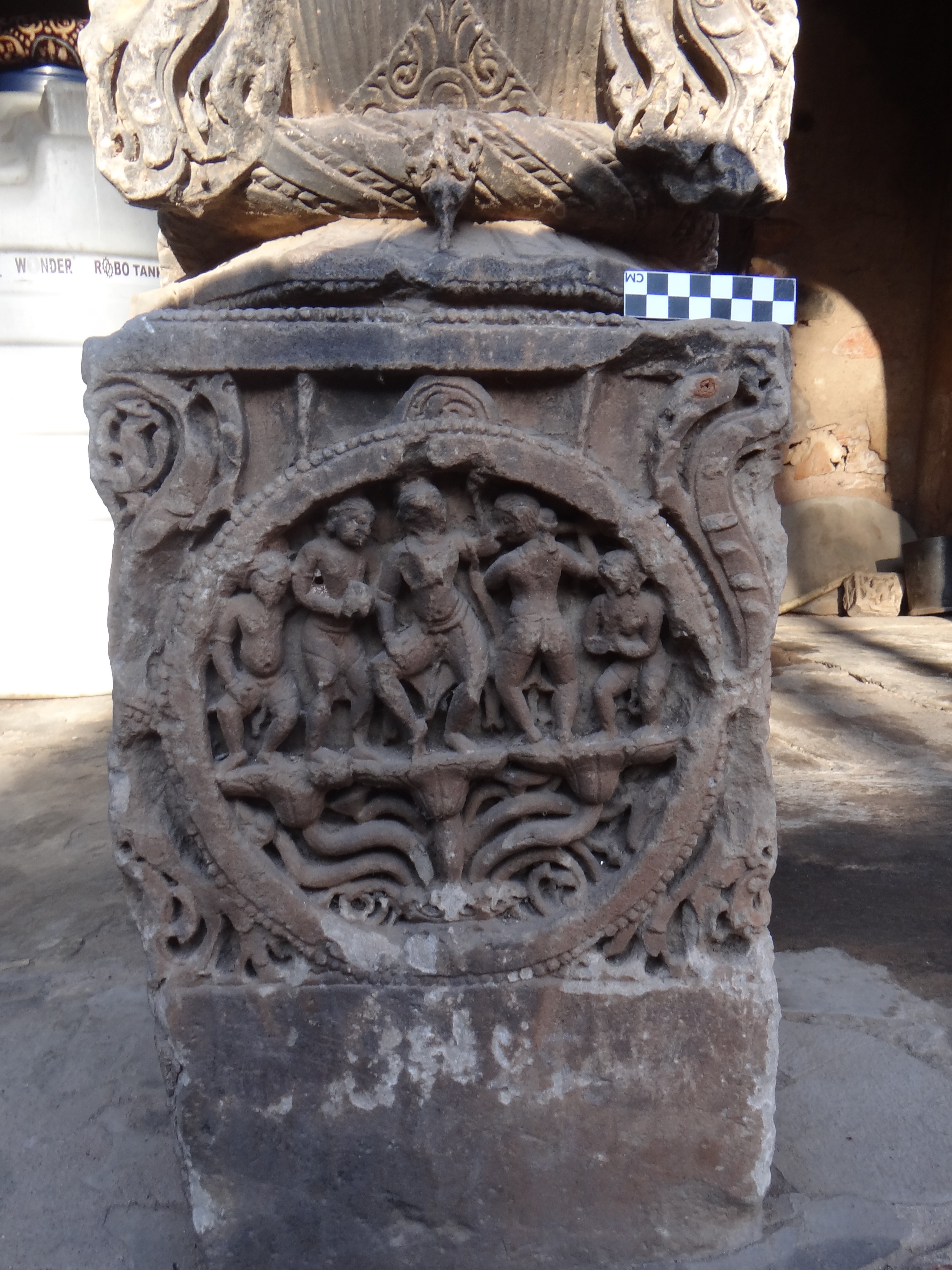
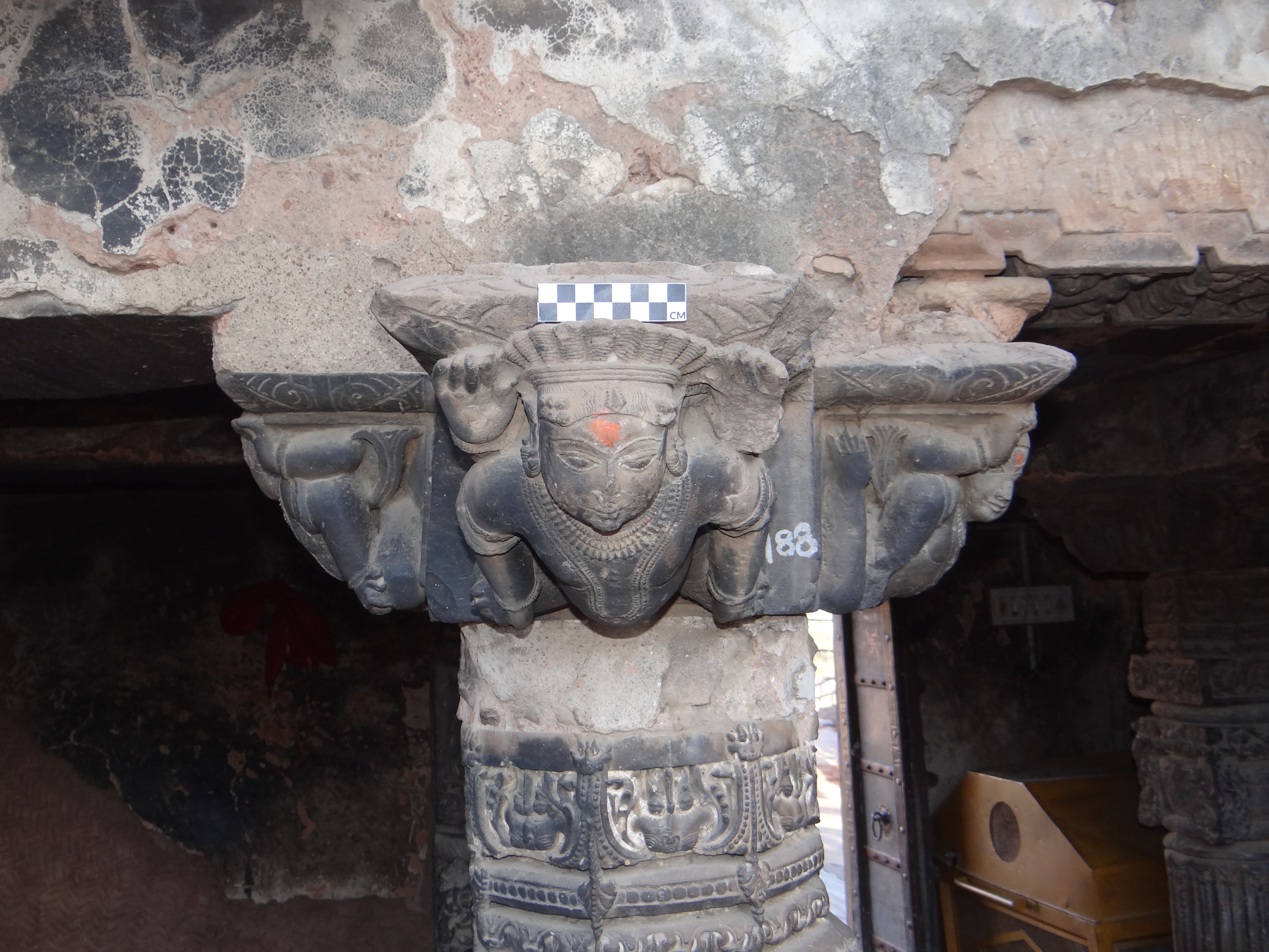
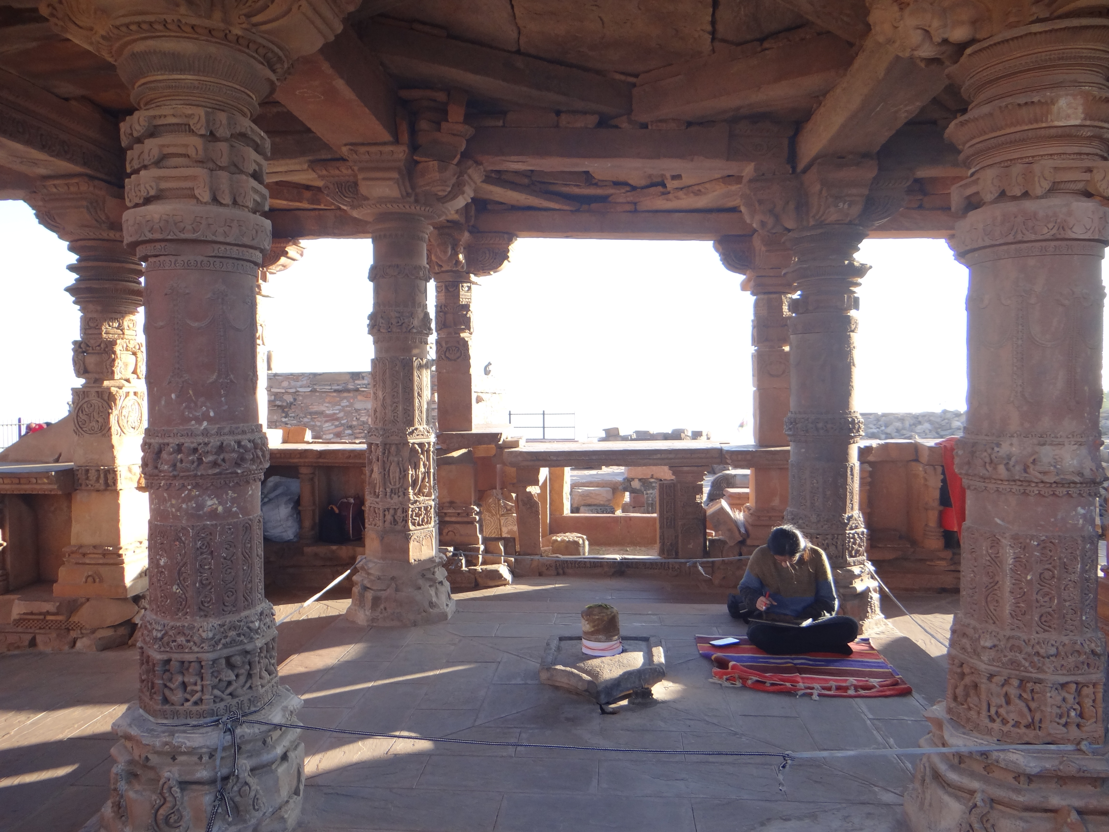
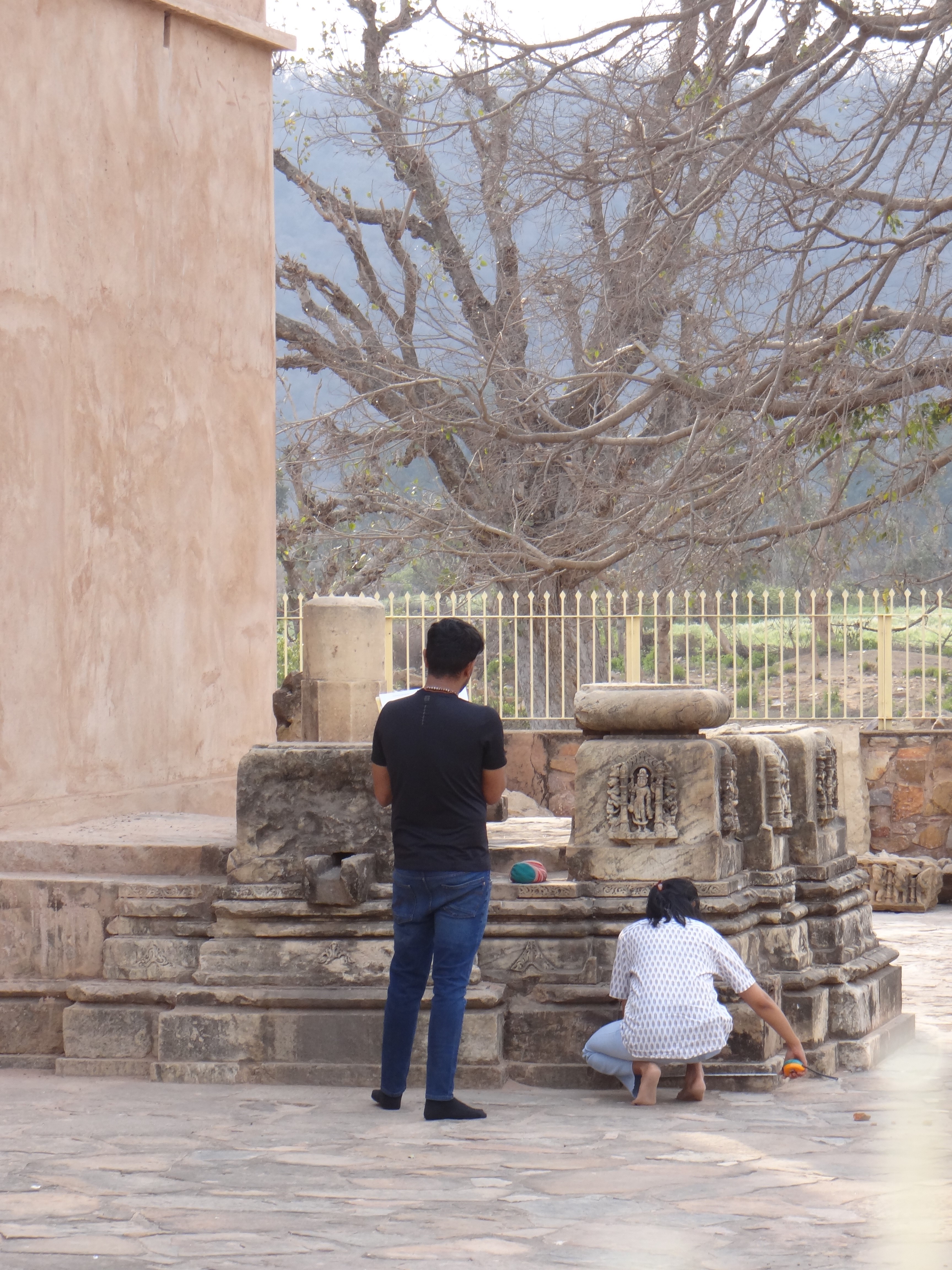
The primary documentation method for the Temples of India Project was non-image-based surveying. The temple heritage sites were hand-surveyed by professionals. Some limitations while documenting these heritage sites were that in a period of six months, detailed documentation was infeasible; once the information was recorded on-site, there was no way to cross-check the data off-site. The data was then compiled on CAD in the form of drawings. For details, photography was considered using a centimeter-grid scale.
LiDAR scanning could document the overall temple structures and context with more time and resources. Drone imagery for high shikharas (superstructures), as well as photogrammetry for detailed iconography and carvings, would provide detailed documentation. These techniques would be more efficient in terms of resource utilization and quality of results.

Footnotes:
[1] Walker M. and P. Marquis-Kyle. The Illustrated Burra Charter: good practice for heritage places. Australia ICOMOS Inc, 2004
[2] Press Trust of India. “Parliament panel asks about '50 missing monuments', recommended urgent survey by ASI.” www.telegraphindia.com/india/parl-panel-asks-about-50-missing-monuments-recommended-urgent-survey-by-asi/cid/1967955
[3] Hassani, Fereshteh. "Documentation of cultural heritage; techniques, potentials, and constraints." The International Archives of the Photogrammetry, Remote Sensing and Spatial Information Sciences 40 (2015): 207-214.